Mt. Yatsu-ga-take (八ヶ岳)
elev. 2899m
Japan's 33rd Highest Mountain
Mt. Yatsu-ga-take (八ヶ岳) is a group of 8 inactive volcanic peaks that is
listed among the 100 famous mountains in Japan (Nihon Hyakumeizan,
日本百名山). Of all the highest mountains in Japan that I’ve climbed through
the years, Mt. Yatsu-ga-take (八ヶ
岳) was one of my
favorites.
Why? Well, for starters, among the highest mountains in Japan, besides
Mt. Fuji, it is probably the most accessible
Japan highpoint from Tokyo, as it is possible to reach the trailhead in
less than
3 hours from Shinjuku. When I climbed this peak in August 2000, I
left Shinjuku by bus early
on a Thursday morning and was back in Tokyo by that Saturday night.
Secondly, even though you gain a respectable 1400m from the
Minodo-guchi (美濃戸口) trailhead to the summit of Aka-dake (赤岳), elevation
2899
m, the
highest of Yatsu-ga-take’s 8 peaks, the climb is not that difficult.
And as I recall, there wasn’t even any scrambling involved. This 1400m
elevation gain is comparable to climbing Mt. Fuji from either the
Kawaguchiko Yoshida or Fujinomiya Fifth Stations.
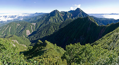
Mt. Aka-dake (赤岳) and Mt. Amida-dake, from Mt. Gongen-dake
(Photo courtesy: Wikipedia)
Lastly, you can’t beat the view from the top. Like Mt. Fuji and Mt.
Ontake-san, Mt. Yatsu-ga-dake is independent & not part of the
famous Japan Alps. And so on a clear day, you have an unobstructed view
of not only Mt. Fuji, but the Southern, Central, and Northern Japan
Alps.
Oh, I forgot. I would be seriously remiss not to mention one of the
highlights of this trip. And that is, after 21 years of hiking in the
highest mountains in Japan, this is the only time I can ever recall
staying in a mountain hut up on a hiking trail that actually had a hot
spring bath in it. Made from Japanese cypress, no less! Now
that was NICE! YEAH!!
Day 1 - August 10, 2000
My Alpico highway bus departed from the west side of Shinjuku Station
at 8:30 am and arrived at the Minodo-guchi (美濃戸口) trailhead just before
noon.
I
didn’t hang around the bus stop very long before hitting the trail, and
because my goal for the night was the hot spring at the Aka-dake
Kosen (赤岳鉱泉) mountain hut, I took the left trail. The trail to
the right is the most direct route up to the summit of Aka-dake (赤岳).
After about an hour, I reached Minodo (美濃戸), where there’s a group of 3
mountain huts. Here is where a trail branches off to the left, and
which crisscrosses the scenic Kitazawa (北沢) mountain stream a
number of
times while climbing up to the elev. 2340m Aka-dake Kosen (赤岳鉱泉) hot
spring
mountain hut.
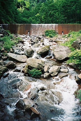
Kitazawa (北沢) mountain stream
Before dinner, women get an hour to soak in the hot
spring and then the men get their hour of relaxation. Of course, ladies
first! 
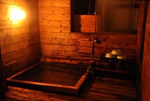
Japanese cypress hot spring bath
at Aka-dake
Kosen (赤岳鉱泉)
(Photo credit: Aka-dake
Kosen)
This page shows some other pics of Aka-dake Kosen
(赤岳鉱泉), inside & out (scroll down to see them!). The
din-din
here was very tasty!
The 6.5 km trek from the Minodo-guchi (美濃戸口) trailhead up to the
Aka-dake
Kosen (赤岳鉱泉) mountain hut takes about 3 hours.
Day 2 - August 11, 2000
I got a bright and early start on this gorgeous day and
headed 40 min. over to the Gyoja-goya
mountain hut (行者小屋), where I took the
left-hand trail (Jizo-one, 地蔵尾根) ridge up to Jizo-no-kashira (地蔵ノ頭).
In Japanese culture, Jizō (地蔵), or Ojizō-sama, is the guardian of
children
and patron deity of deceased children. In particular, he has been
worshipped as the guardian of the souls of children who died before
their parents, including stillborn, miscarried, or aborted fetuses. His
statues are a common sight, especially by roadsides and in graveyards,
and oftentimes in the mountains.
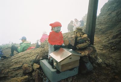
Jizo (地蔵) statue @ Jizo-no-kashira (地蔵ノ頭)
Jizō (地蔵) statues are usually seen wearing tiny children's clothing or
bibs
(usually red-colored), or with toys, put there by grieving parents to
help their lost ones and hoping that Jizō (地蔵) would specially protect
them.
Jizō's features are commonly made more babylike to resemble the
children he protects. Jizō (地蔵) statues are sometimes accompanied by a
little pile of stones and pebbles (or other miscellaneous offerings),
put there by people in the hope that
it will shorten the time children have to suffer in the underworld.
Jizo-no-kashira (地蔵ノ頭) is where you join the main trail coming over
from Yoko-dake (横岳). After hanging a right at this trail junction, it’s
just
a short distance over to the Aka-dake-tenboso
(赤岳天望荘, elev. 2700m)
mountain hut which also has a small hot spring.
After a short rest here, I headed up the final 200m ascent to the
Aka-dake (赤岳) summit. Just before reaching the summit, I passed the Aka-dake
Chojo-goya (赤岳頂上小屋) mountain hut, which sleeps 300. The summit of
Aka-dake is graced by a
couple of tiny shrines as well as numerous small concrete monuments. As
mentioned above, the view from the top of Aka-dake (赤岳) was truly
stunning.
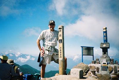
Mt. Aka-dake (赤岳) summit, elev. 2899m
(the
highest of Mt. Yatsu-ga-take’s 8 peaks)
My hike back down into civilization was fairly uneventful, but
the gorgeous greenery along the Minamisawa (南沢) mountain stream was
very
mentally refreshing. And relaxing in the onsen at my pension in the
Haramura Pension Village (原村ペンションビレッジ) was a great way to soothe my
aching
muscles. Well, I must say the 500-ml can of Asahi Super Dry beer
certainly helped improve the mood as well. 
In the evening, I was hoping to catch the Perseid meteor shower, but
unfortunately clouds moved in before midnight.
Day 3 – August 12, 2000
This day was a very relaxing one, since my return bus back to Shinjuku
didn’t depart until almost 4:00 pm, arriving back in Shinjuku just
before 8:00. I spent most of this sunny day just hiking around doing a
little birdwatching, and relaxing in the very amazing nearby Yatsu-ga-take
Natural & Cultural Park (八ヶ岳自然文化園), which had a pond,
mini-golf, croquet,
picnic area,
cycling course, flower gardens, and even a planetarium.
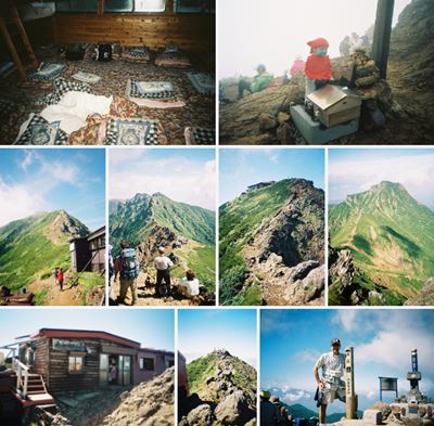
My Mt. Yatsu-ga-take (八ヶ岳) Pics
The pics below are in my Yatsu-ga-take (八ヶ岳)
photo
album hosted at Flickr. I
hope
you enjoy them!
Click
collage above to view my Mt. Yatsu-ga-take (八ヶ岳) pics, taken
Aug. 10-12, 2000, back when I still had dark hair. 
My Google Map of Mt. Yatsu-ga-take (八ヶ岳)
In Oct. 2009 I created the customized map below, as I thought it'd be
cool to see all of Japan's 25 highest mountains at a glance.
Although
as Japan's 33rd highest peak, Mt. Yatsu-ga-take (八ヶ岳) is not among the
25 highest, zooming out on the map below will allow you to see all of
the 25 highest mountains in Japan.
(zoom out to see all 25 highest
mountains)
Aka-dake (赤岳), shown above, is the highest of Mt.
Yatsu-ga-take's (八ヶ岳) 8 peaks
View 25 Highest Mountains
in Japan in a larger map
Route Map & Elevation Profile
of Mt. Yatsu-ga-take (八ヶ岳)
Mt. Yatsu-ga-take (八ヶ岳)
Climbing Distances & Times
Place
|
Elev. (m)
|
Approx.
distance from
last place (km)
|
Approx.
time from
last place
(hr:min)
|
Minodo-guchi
(美濃戸口)
|
1500
|
-
|
-
|
Kitazawa
trail junction
(北沢分岐) |
1740
|
3.0
|
1:00
|
Aka-dake
Kosen
(赤岳鉱泉) |
2300
|
3.5
|
2:00
|
Gyoja-goya
(行者小屋) |
2350
|
1.0
|
0:40
|
Jizo-no-kashira
(地蔵ノ頭) |
2722
|
0.8
|
1:20
|
Aka-dake
summit
(赤岳頂上) |
2899
|
0.6
|
0:30
|
Gyoja-goya
(行者小屋) |
2350
|
1.1
|
1:00
|
Kitazawa
trail junction
(北沢分岐) |
1740
|
3.7
|
1:45
|
Minodo-guchi
(美濃戸口) |
1500 |
3.0
|
0:45
|
Course total
|
-
|
16.7
|
9:00
|
Access
To my knowldege, the Alpico bus company doesn't provide direct bus
service from Shinjuku to Minodo-guchi (美濃戸口) anymore (as it did 12 yrs.
ago when I made my trip), but some bus service to Minodo-guchi (美濃戸口)
from Tokyo is
now available from the Mainichi Shinbun Travel Service. More info in
Japanese is near the bottom of this page
and at 03-6265-6966.
Another option is to take the Super Azusa limited
express train (JR Chuo Main Line)
from Shinjuku Station (新宿駅)
to Chino Station (茅野駅), and then catch the Alpico bus from there to the
Minodo-guchi (美濃戸口) trailhead. The bus schedule from Chino Station
(茅野駅) to
Minodo-guchi (美濃戸口) is on the Alpico Bus website.
Generally speaking, the summer bus runs from late April to early
November.
Real-time route search with time schedules for the Shinjuku to
Chino JR express train service can be found here. Also, there are obviously
slower and cheaper ways to get there on JR's Chuo Main Line. More info
in
English is available from JR East at (050) 2016–1603, 10:00 to 18:00,
every day of the year except during the year-end/new year
holidays.
The fastest Super
Azusa trains from Shinjuku Station (新宿駅) to Chino Station (茅野駅) take
as little as only 2 hours.
And from Chino Station (茅野駅), it only takes about 40 min. by bus or
taxi to
reach
the Minodo-guchi (美濃戸口) trailhead.
That's right..... if your train and
bus
schedules work out right, you can be hiking in less than 3 hours
after leaving Shinjuku. Among Japan's highest mountains, this makes Mt.
Yatsu-ga-take (八ヶ岳) without question one of the most easily accessible
peaks from
Tokyo.
And if you can get to the Minodo-guchi (美濃戸口) trailhead early enough in
the day, because it only takes around 4 hrs. to climb to the summit of
Aka-dake (赤岳), many folks do this route as a day hike.
Historic Kofu
If you have any extra time to kill after your hike and don't need to
rush back home, I highly recommend that you soothe your sore muscles in
a nice hot spring
rotemburo in the Yumura Spa area, a 10-minute bus
ride from JR Kofu Station. And it'll only dent your pocketbook by
¥700 or so.
Kofu is a very historic city, known as the home of Takeda Shingen, one
of Japan's most powerful 16th-century warlords. And because about 30%
of
Japan’s carved jewelry is produced in the area, Kofu is known as
Japan's most famous jewelry city.
Kofu is also home to Hidetoshi Nakata, the world-famous soccer player
who last played in the Premier League and retired following the 2006
World Cup, and Naoko Takeuchi, creator of "Sailor Moon" and other
comics.
So if you have a few extra hours to kill in Kofu, besides the
abundant hot
springs, there are a number of fun things to see and do there,
including the Shosen Gorge, Takeda-jinja Shrine
(dedicated to the
famous warlord), and the Yamanashi
Prefectural Museum of Art.
Please stop by again soon
My Aug. 10-12, 2000 climb of Mt. Yatsu-ga-take (八ヶ岳) was an awesome
hiking trip. From these
peaks, on a clear day the views
of Mt. Fuji & other nearby peaks in the Northern Japan Alps
(北アルプス), Southern Japan Alps (南アルプス), & Central Japan Alps (中央アルプス)
will
take your breath away.
The only drawback about
hiking during the busy Obon holidays in Japan, though, is you
are certain to encounter crowded conditions on the trails & in
the huts. But I guess that just comes with the
territory, because like Golden Week and the New Year's holidays, during
Obon most Japanese tend to all vacation at the same time, making the
trains, planes, and highways pure mayhem.
On the bright side, I seem to
have noticed a trend in recent years for Japanese companies to start
staggering their vacation times a bit, but even in 2012, 25-30 km long
traffic jams were typical on the expressways during the Obon holidays.
I hope you found this page
informative & do please stop by
again soon, as
I hope to update it in the future with more details on climbing Mt.
Yatsu-ga-take (八ヶ岳).
In the meantime, if you have any quick questions, feel free to
give me a shout
by posting them in the "Add your comment" section below or by clicking
on the "Contact Me" link at the top right of this page.
And
if you've already climbed Mt. Yatsu-ga-take (八ヶ岳) & you'd
care to
pay it forward & share your climbing story & pics with
other
climbers, we'd love to hear of your personal experience.
You
can share your story here.
If you're lucky enough to
hike up any of the 8 Mt. Yatsu-ga-take (八ヶ岳) peaks, I wish you my most
heartfelt
good
luck. GO FOR IT !!

Additional links:
Mt. Yatsu-ga-take (八ヶ岳) summit
6-day weather forecast
Mt. Yatsu-ga-take (八ヶ岳) topo
map (from the Geospatial Information Authority of Japan)
Mt.
Yatsu-ga-take (八ヶ岳) route map (2023 1:50,000 hiking map, part of the
Yama-to-kogen Chizu series published
by Shobunsha, available in bookstores and from Amazon Japan)
|
|








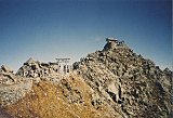
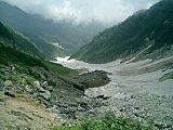
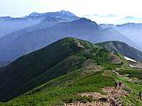
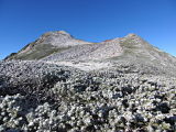


New! Add your comment
Have your say about this page! Feel free to comment in the box below: